This map is a section of a larger one of the Wetlands of the Laurentians produced by Ducks Unlimited, the world’s largest private, non-profit, waterfowl and wetland conservation organization, and Abrinord, the organization responsible for the management of the North River Watershed.
Wikipedia defines a wetland as a land area that is saturated with water, either permanently or seasonally, such that it takes on the characteristics of a distinct ecosystem. Wetlands play a number of roles in the environment, principally water purification, flood control, carbon sink and shoreline stability.
Wetlands are also considered the most biologically diverse of all ecosystems, serving as home to a wide range of plant and animal life.
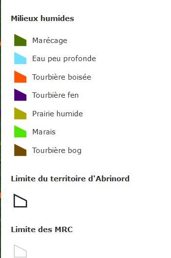
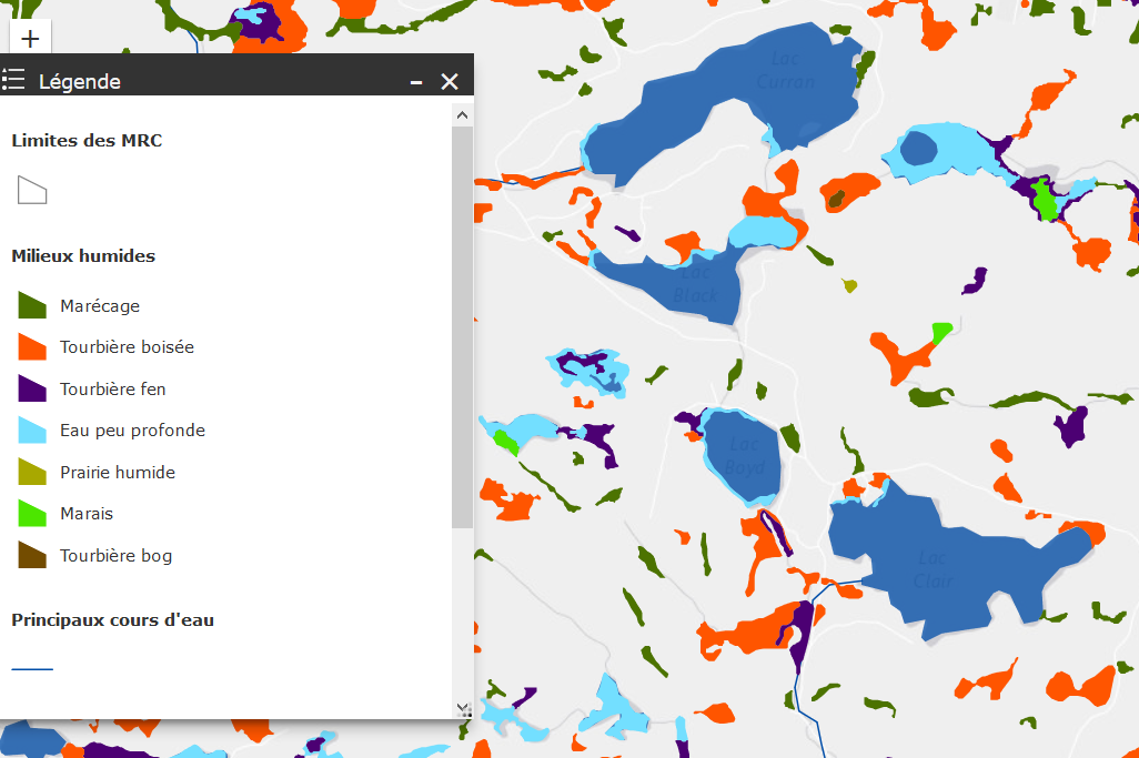 The map is only available in French. Key words in the legend are marécage, marais (Swamp), Tourbière (Bog), eau peu profonde (shallow water) .
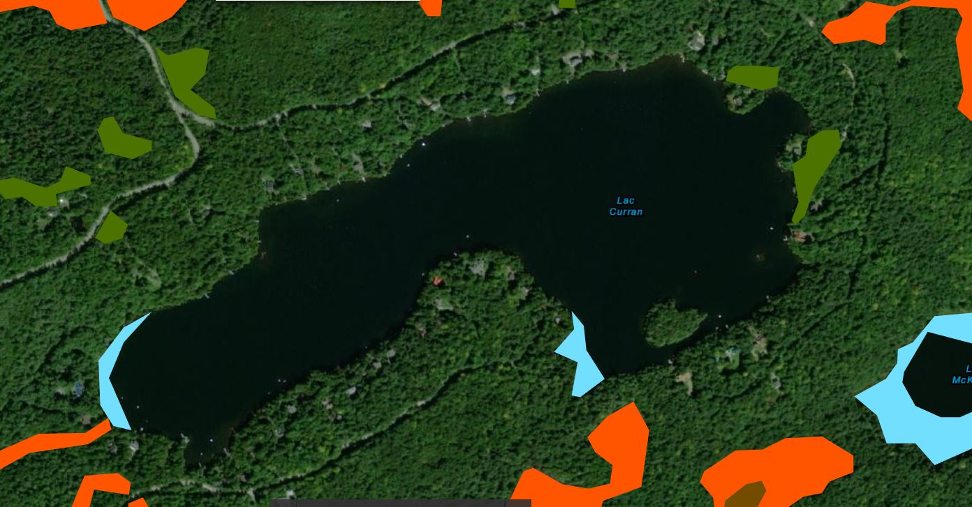
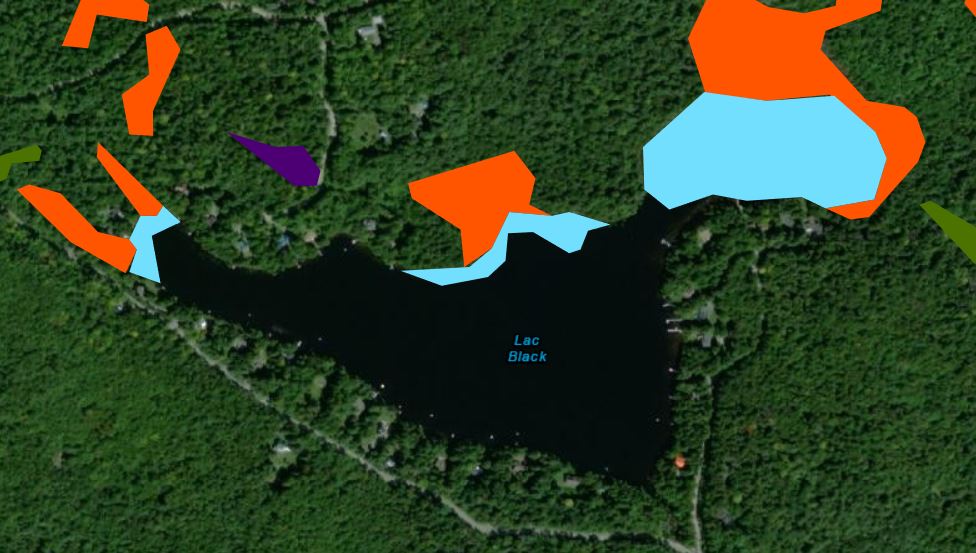
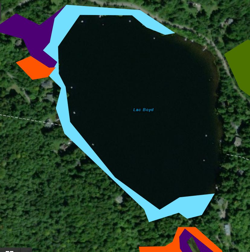
It was produced though 3-D imagery. It is quite precise. For example, there are small bogs with trees (tourbière boisée) on and close to my property and they are clearly shown.
Now, have a look at wetlands around our lakes.

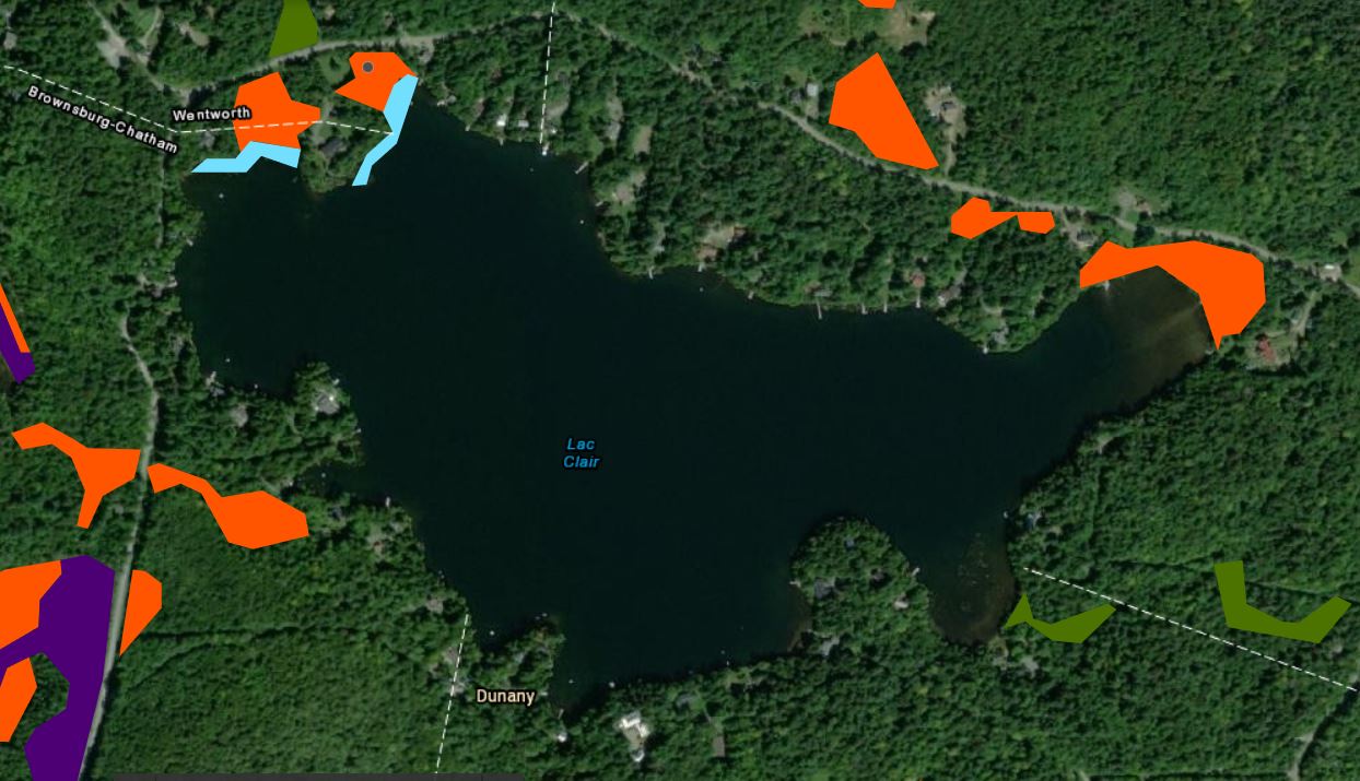
I am sharing this information with you as the health of our lakes is inseparable from the preservation of our wetlands as they play vital functions such as water filtration, water storage, biological productivity, and provide habitat for wildlife.
To view the full map, just click on this link.