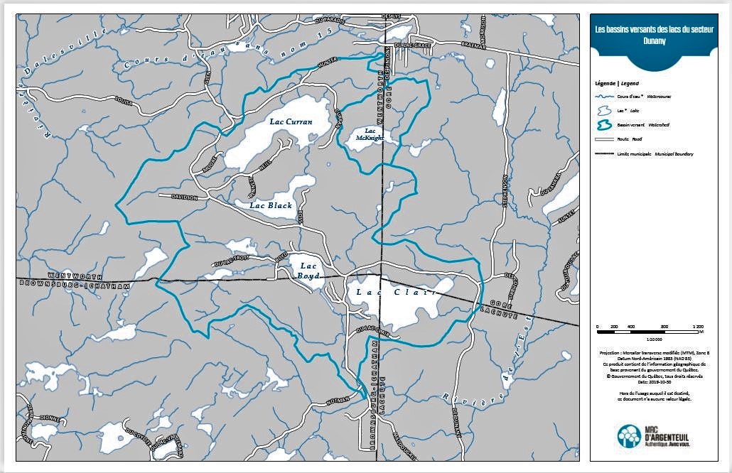
You hear a lot about watersheds. They are defined as an area of land where all the surface water drains into the same place, whether it’s a creek, a stream, a river or an ocean. Therefore, all precipitation, such as rain or snow, that falls on a watershed ends up flowing to the same place.
Even though Dunany is defined by its watershed, we never had a real map. Until now.
The MRC of Argenteuil has just produced one. The following image is a cut out from that map.
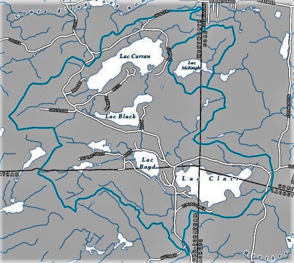
You will notice that lake McNignt is cut out from iour watershed. That is because it is not part of it even if it sits at the same altitude as Black (265.9 metres). Since a ridge separates them, they do not connect.
Also, our four lakes – Curran, Black, Boyd and Clear – drain on a North-South axis as McNight drains eastward. They both end up in the East river at different junctions and, later, in the North River.
This is the full map, as produced by the MRC.